About Sundial Atlas Mobile
The program shows the map of the country around your position, it then makes access to the data base of Sundial Atlas (www.sundialatlas.eu) and it downloads all the sundials that are present in the map that is shown on...
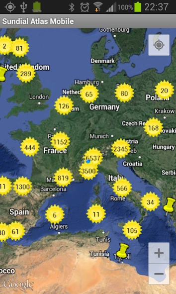
The program shows the map of the country around your position, it then makes access to the data base of Sundial Atlas (www.sundialatlas.eu) and it downloads all the sundials that are present in the map that is shown on the display.
Each sundial is represented by an icon on the place where it is installed (if the icons are more than 200 then the app collects them under a single icon in order to avoid the user interface slowing down).
The map can be dragged and zoomed.
A find command can be used to show the map around a desired known place.
Sundials downloaded from internet are stored in a local data base.
Therefore when an internet connection is not available, or the user denies the permission to use it by means of the dedicated option in the preferences, it is still possible to explore the map.
A click on a sundial icon opens a window where a low resolution image of the sundial (just downloaded from internet if available) is shown together with its ID (f.i. IT3979), its geograpic coordinates and its location precision as declared when registered to Sundial Atlas.
A click on this window opens a dialog where, together with a medium resolution image of the sundial (if a connection is available), the following commands are available:
- "Sundial Atlas data sheet" shows the sundial data sheet in the Sundial Atlas site using the predefined browser
- "navigator" opens the navigator with the sundial coordinates as the destination
- "Street View" opens Street View on the sundial place
A menu command shows some statistic information about the local data base and the map that is shown on the display.
Sundial Atlas Mobile needs the following permissions:
- network connession for maps and sundials download
- GPS localization
IMPORTANT
If you have any problem with this app please let me know what's happening !
This is the only way for me to be informed and try to solve the problem (this app supports more than 5000 devices, I cannot test it on everyone !)
You can send me an e-mail. Or you can authorize the transmission of the report log that is automatically created by Android when an app crashes: this report is completely anonymous.
More information on the program are available from the author's site:
http://digilander.libero.it/orologi.solari
From this same site a complete free program for sundial design and simulation is available (Windows only).
Other apps from the same author: SolEtUmbra shows the sun ephemerides, shows a sundial as computed on the plane that contains the device display, shows the path of the sun in the sky.
The author can be contacted at the address:
[email protected]
Sundial Atlas Mobile develoment has been made possible through the s/w code that Fabio Savian has developed on the server side.
Previous Versions
Here you can find the changelog of Sundial Atlas Mobile since it was posted on our website on 2016-12-22 13:17:51.
The latest version is 2.14 and it was updated on 2024-04-22 16:57:52. See below the changes in each version.
Sundial Atlas Mobile version 2.14
Updated At: 2024-02-26
Sundial Atlas Mobile version 2.11
Updated At: 2023-04-02
Changes: 2.11: migrated to Active-X
Sundial Atlas Mobile version 2.9
Updated At: 2021-01-23
Changes: modifed according to Google location retrieval policy
Sundial Atlas Mobile version 2.8
Updated At: 2018-06-29
Changes: rev. 2.8
Updated for new Google requirements
rev. 2.7
Error fixed
rev. 2.6
Error fixed
rev. 2.5
Color code added to pushpins
rev. 2.4
Polish language added
rev. 2.3
minor bugs fixed
rev. 2.2
map can now be displayed in normal view (as opposite to satellite view)
rev. 2.0
user interface upgraded
rev. 1.11
fixed an issue with the "find" menu command
rev. 1.8 - 1,9
improved several features
rev. 1.5 - 1.7
now public "paths" can be selected to filter out the sundials on the display
Sundial Atlas Mobile version 2.5
Updated At: 2016-10-01
Changes: rev. 2.5,Color code added to pushpins,rev. 2.4,Polish language added,rev. 2.3,minor bugs fixed,rev. 2.2,map can now be displayed in normal view (as opposite to satellite view),rev. 2.0,user interface upgraded,rev. 1.11,fixed an issue with the "find" menu command,rev. 1.8 - 1,9,improved several features,rev. 1.5 - 1.7,now public "paths" can be selected to filter out the sundials on the display
Disclaimer
Official Google Play Link
We do not host Sundial Atlas Mobile on our servers. We did not scan it for viruses, adware, spyware or other type of malware. This app is hosted by Google and passed their terms and conditions to be listed there. We recommend caution when installing it.
The Google Play link for Sundial Atlas Mobile is provided to you by apps112.com without any warranties, representations or guarantees of any kind, so access it at your own risk.
If you have questions regarding this particular app contact the publisher directly. For questions about the functionalities of apps112.com contact us.